Feature packed Civil Engineering tool for displaying Geometric alignments, lines, points and cross sections.
Designed to assist highway and railway construction/maintenance engineers.
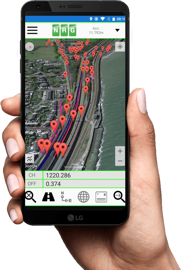
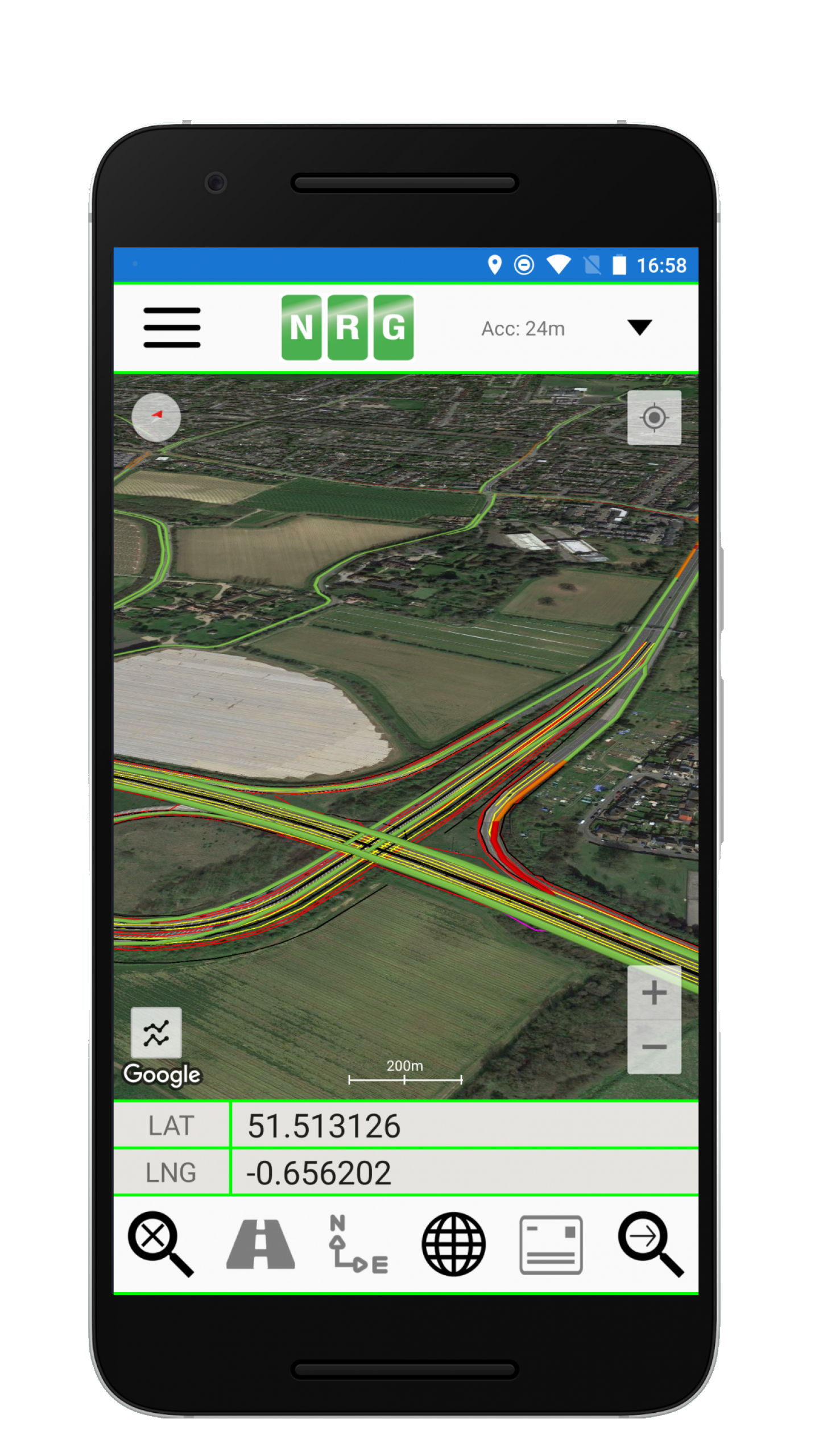
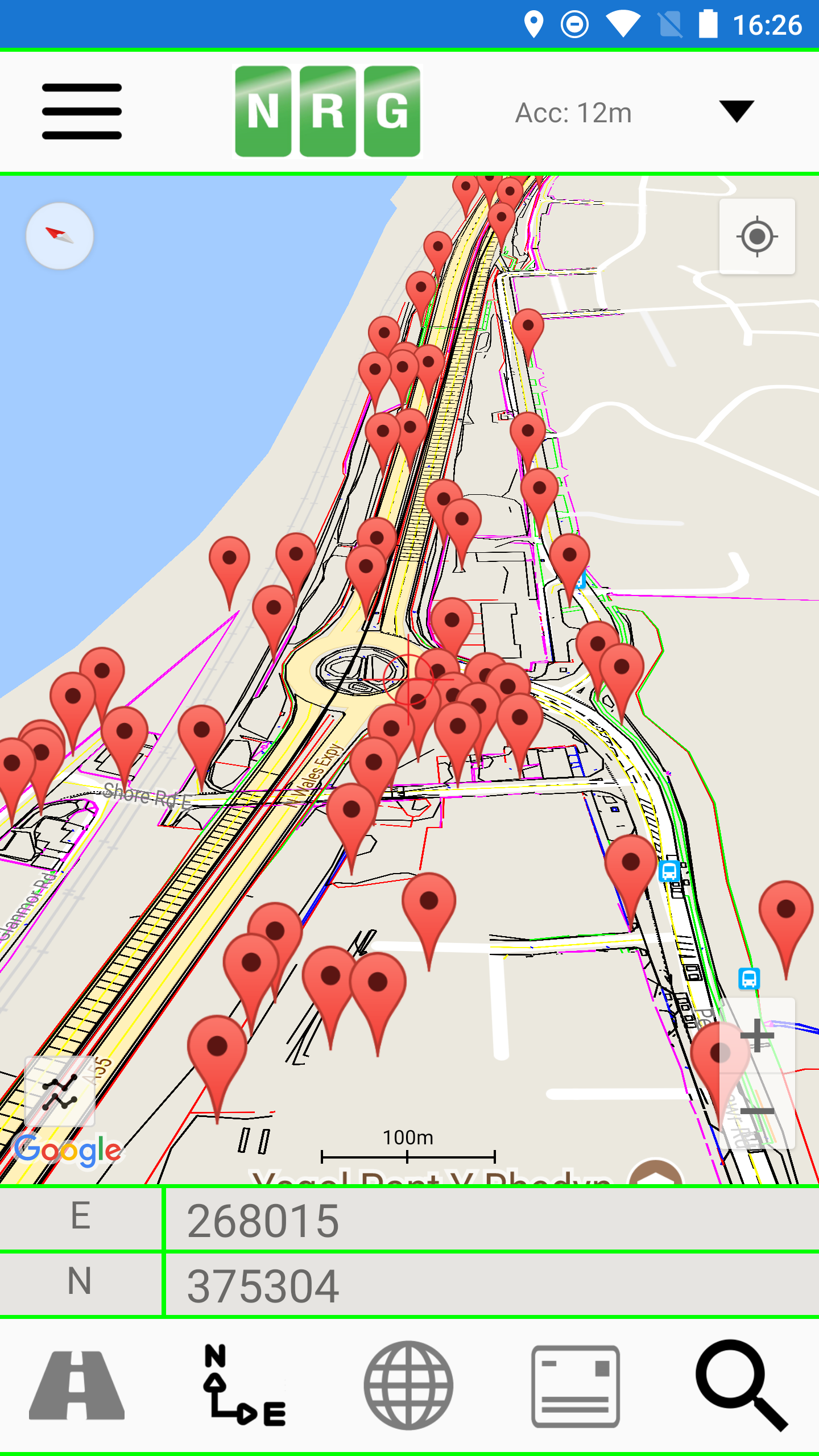
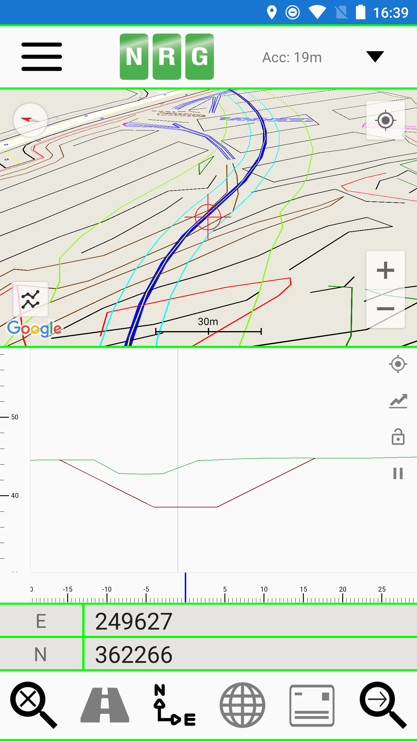
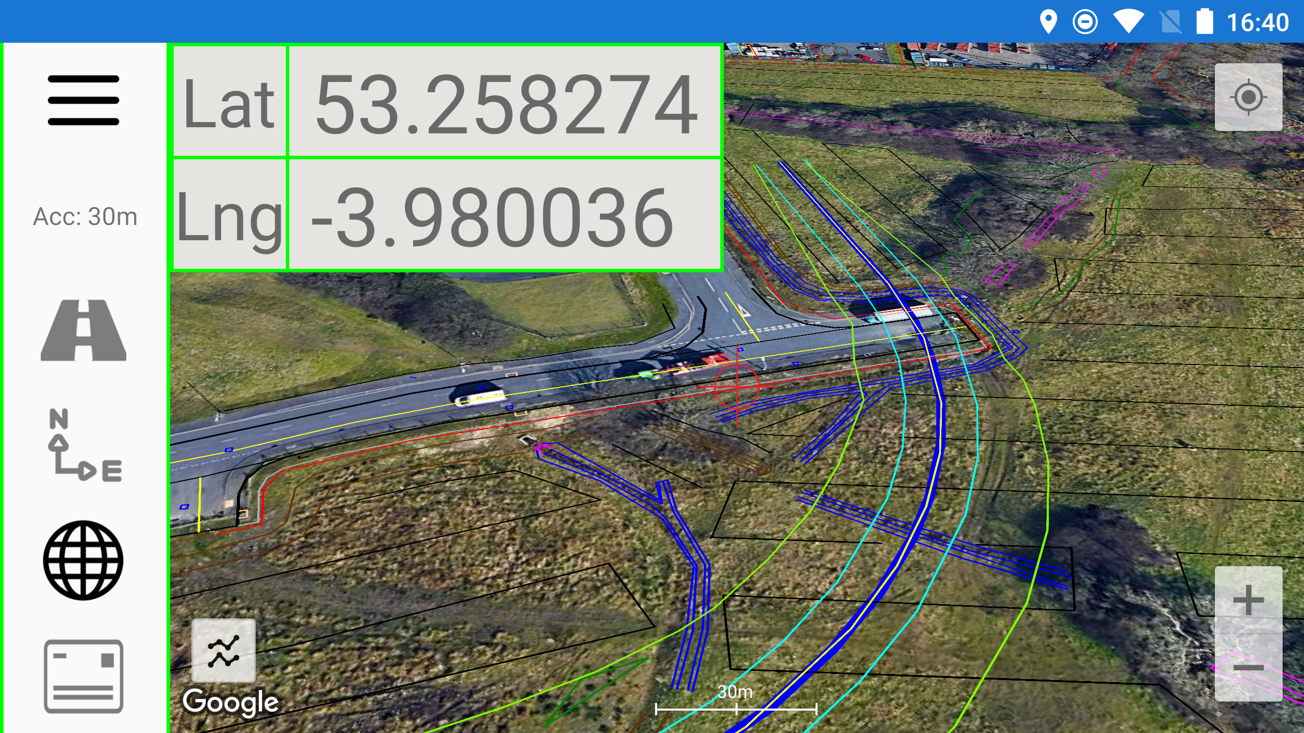
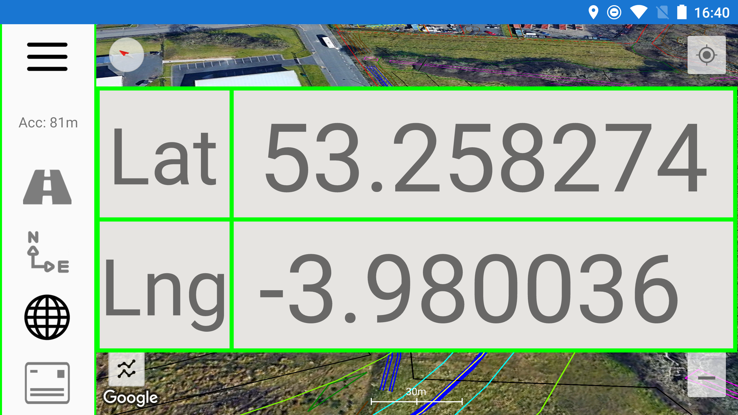
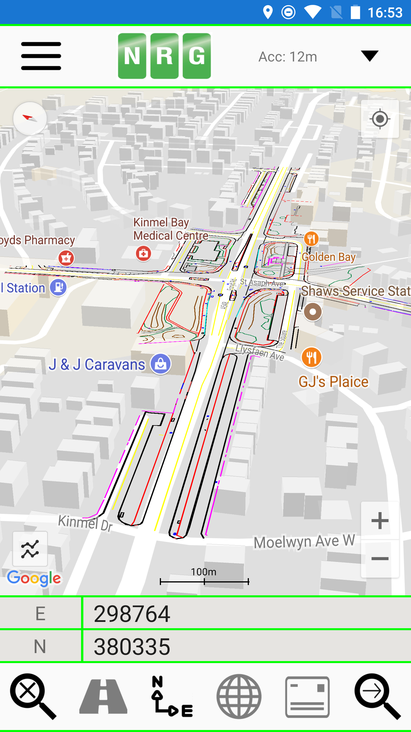
Alignment Viewer allows the conversion between Geodetic WGS84/ETRS89 World coordinates (Latitude Longitude) to cartesian Easting Northing and Geometric alignment coordinates based on a given transformation.
Geometric alignments - Alignment Viewer provides support for geometric alignments incorporating curves, spirals, clothoids, parabolas and straights.
Geometric pins points and lines - Import lines and pins from Google Earth file (.kml) and load to map, cross section or both.
Water mark photos with chainage / station and offset
The NRG Alignment Viewer app is a useful civil Engineering tool. The app will allow you to display geometric alignments, lines, points and cross sections on your mobile device.
The app has been extensively developed and designed to assist highway and railway construction/maintenance engineers.
The NRG Alignment Viewer app allows the conversion between Geodetic WGS84/ETRS89 World coordinates (latitude longitude) to cartesian easting, northing and Geometric Alignment coordinates based on a given transformation.
If no transformation is given OSGB36 (UK) will be used as default.
The NRG Alignment View app provides a track mode and a search mode.
When using track mode, get real-time updates of your device GPS position in WGS84, cartesian EN and geometric alignment formats. The postcode for your current location can also be requested on demand.